
ProgeCAD for Civil & Structural Engineering: CAD Software for Engineers
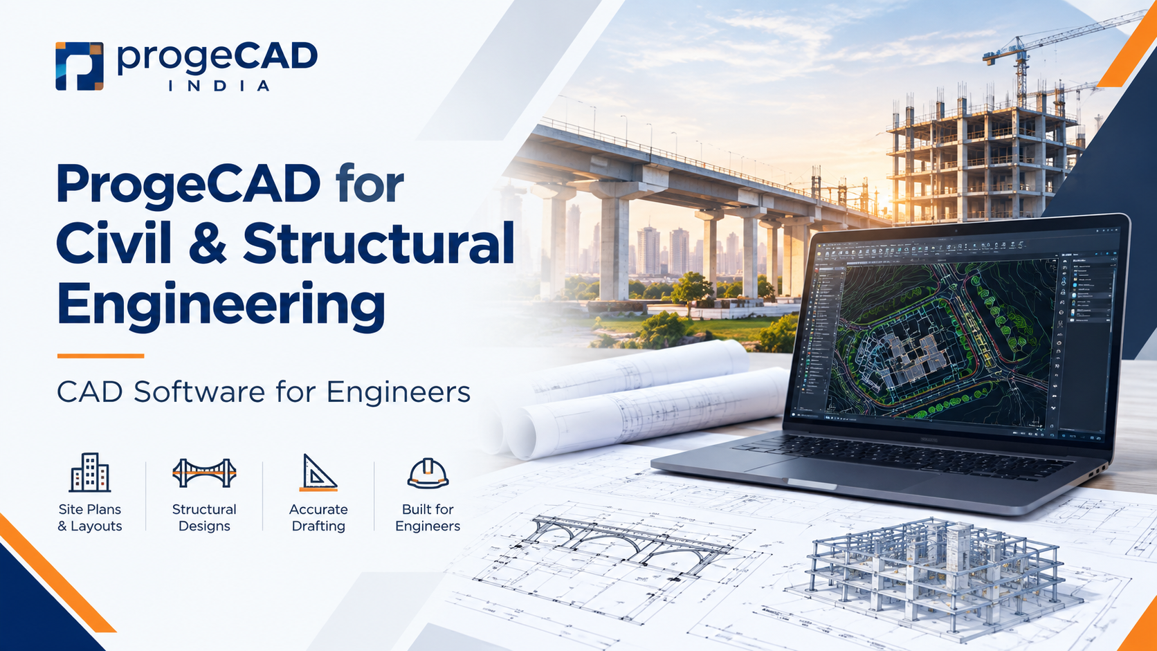
ProgeCAD for Civil & Structural Engineering
ProgeCAD for Civil & Structural Engineering is a DWG-compatible CAD solution for civil engineers, structural engineers, CAD technicians, surveyors, and engineering teams. It supports detailed technical drafting, structural drawings, civil engineering documentation, surveying, GIS, terrain-related workflows, BIM, and PDF-to-CAD workflows.
What Is ProgeCAD for Civil & Structural Engineering?
ProgeCAD for Civil & Structural Engineering provides tools for creating, editing, and documenting engineering drawings while working with DWG files.
ProgeCAD for Civil & Structural Engineering Workflows
With ProgeCAD for Civil & Structural Engineering, engineers can prepare plans, sections, elevations, dimensions, construction details, schedules, and other technical documentation.
ProgeCAD is designed for professionals who need a DWG-compatible CAD platform for engineering drafting and documentation. Its tools can support civil engineering, structural drafting, surveying, GIS, terrain-related workflows, BIM coordination, and technical drawing production.
Download ProgeCAD | View ProgeCAD Pricing
What Is ProgeCAD for Civil & Structural Engineering?
ProgeCAD for Civil & Structural Engineering is a CAD solution for engineers, designers, and drafting professionals who need to create and manage detailed technical drawings. The software supports native DWG and DXF workflows together with 2D drafting, 3D modeling, surveying, GIS, terrain, point-cloud, BIM, and PDF-to-CAD capabilities.
Instead of replacing specialized engineering analysis applications, ProgeCAD focuses on the CAD and documentation side of engineering projects. It can be used to prepare drawings, details, layouts, sections, annotations, schedules, and construction documentation.
Is ProgeCAD Good for Civil Engineering?
ProgeCAD can support many common civil engineering drafting and documentation requirements. Civil engineers and technicians can use it to prepare site drawings, plans, sections, elevations, technical details, topographic documentation, and other DWG-based project drawings.
Its surveying, GIS, terrain, point-cloud, and 3D capabilities can also help connect engineering drafting with real-world geographic and site information.
ProgeCAD for Civil & Structural Engineering Workflows
With ProgeCAD for Civil & Structural Engineering, engineering teams can create organized drawing sets while continuing to work with familiar DWG files. The workflow can include drafting, editing, annotation, dimensioning, technical detailing, drawing comparison, PDF conversion, and project documentation.
- Civil engineering plans and layouts
- Structural plans and sections
- Construction and technical details
- Topographic and surveying drawings
- Site and infrastructure documentation
- Schedules and engineering tables
- DWG and DXF drawing management
- PDF-to-CAD conversion
- 3D engineering models and visualization
ProgeCAD Civil Engineering Features
Point Clouds and TIN Surfaces
ProgeCAD provides tools for working with point-cloud information and terrain-related data. Engineers can use these capabilities as part of surveying, site documentation, terrain visualization, and engineering drafting workflows.
Topographic Sections
Topographic sections can help engineers represent terrain information in technical drawings. ProgeCAD supports workflows involving sections and elevation information for engineering documentation.
Contour Lines
Contour-related tools can assist with representing terrain and elevation information in civil engineering drawings.
Elevation and Point Information
Civil engineering drawings often require point numbers, elevations, annotations, and coordinate information. ProgeCAD provides tools that can support these types of technical drafting requirements.
Slope Tools
Slope-related tools can assist with terrain visualization and engineering documentation. These capabilities are useful when preparing drawings that communicate changes in elevation and terrain conditions.
GIS and Geographic Data
ProgeCAD includes GIS-related capabilities that can help engineers work with geographic information as part of CAD workflows. Support for ESRI ArcGIS basemaps and geographic data can help connect CAD drawings with location-based information.
Georeferencing
Georeferencing can help position drawing information in relation to real-world geographic coordinates, supporting surveying, mapping, and site-related CAD workflows.
ProgeCAD for Structural Engineering Drafting
ProgeCAD structural engineering workflows can be used for preparing structural plans, sections, elevations, details, schedules, and other technical documentation.
Structural Plans
Engineers and drafters can create detailed structural plans containing grids, dimensions, annotations, structural elements, and construction information.
Structural Sections
Sections can be prepared to communicate structural arrangements, levels, dimensions, connections, and construction details.
Steel and Structural Components
ProgeCAD provides parametric 2D and 3D structural components for construction-related workflows, including steel and wood components.
Construction Details
Detailed construction drawings can include dimensions, notes, callouts, section markers, symbols, and other information required for technical documentation.
Schedules and Tables
Engineering drawings frequently contain schedules and tables. ProgeCAD supports tables, formulas, and Excel-linked workflows that can help organize project information.
How ProgeCAD for Civil & Structural Engineering Supports Technical Drawings

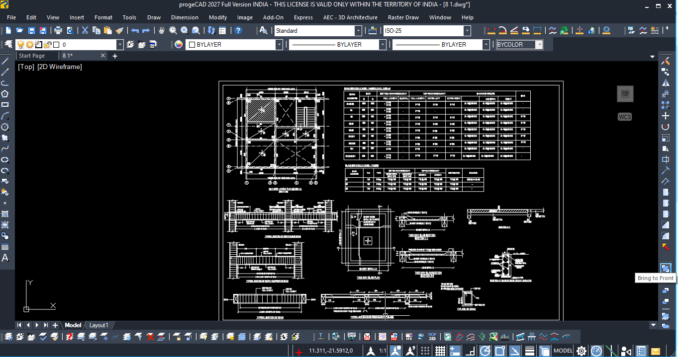
ProgeCAD for Civil & Structural Engineering can be used to prepare complete technical drawing sheets containing plans, sections, dimensions, schedules, annotations, and construction details. This makes it suitable for engineering documentation and drafting workflows where clear and accurate CAD drawings are required.
Working With Existing Engineering DWG Files
Many engineering organizations already have large libraries of DWG drawings. ProgeCAD provides native DWG and DXF compatibility, allowing users to open, edit, create, and save CAD drawings within a familiar workflow.
This can be useful when engineering teams need to continue working with existing project drawings rather than rebuilding documentation from scratch.
PDF to DWG for Engineering Drawings
Engineering teams often receive drawings as PDF documents. ProgeCAD includes PDF-to-CAD capabilities that can help convert suitable PDF drawing information into editable CAD content.
This can be useful when updating older drawings, reusing information from archived documents, or continuing work on drawings received in PDF format.
BIM and Revit Workflows
ProgeCAD supports BIM-related workflows and provides IFC capabilities for exchanging building information. ProgeCAD 2027 also includes enhanced BIM functionality and compatibility improvements for Autodesk Revit workflows.
BIM capabilities can be useful when CAD documentation needs to interact with information originating from building information modeling workflows.
ProgeCAD 2027 for Civil and Structural Engineers
ProgeCAD 2027 is the latest major ProgeCAD release and provides improvements designed to make everyday CAD work faster and more productive. The release includes improvements to object snapping, common editing operations, PDF-to-CAD workflows, GIS, BIM, and other CAD functions.
ProgeCAD 2027 also introduces features such as Flex License, the COMPARE command, floating drawing windows, improved PDF-to-CAD functionality, ESRI ArcGIS basemap support, and enhanced BIM capabilities.
Explore ProgeCAD 2027 Features
Surveying and GIS Workflows
Surveying professionals can use ProgeCAD to combine CAD drafting with geographic and terrain information. Point data, elevation information, terrain models, GIS data, and technical drawings can be incorporated into a broader engineering documentation workflow.
These capabilities can be particularly useful for site documentation, mapping, topographic drawings, and engineering projects that require geographic context.
ProgeCAD for Civil Engineering Projects
ProgeCAD for Civil & Structural Engineering can support drafting and documentation for a variety of civil engineering projects, including:
- Site development drawings
- Topographic plans
- Surveying documentation
- Terrain and elevation drawings
- Infrastructure-related drafting
- Construction documentation
- General civil engineering plans and details
ProgeCAD for Structural Drawing Workflows
Structural drafting teams can use ProgeCAD to prepare drawing sets containing structural plans, sections, elevations, details, dimensions, annotations, and schedules.
A typical workflow may involve opening an existing DWG, creating or modifying structural geometry, adding dimensions and annotations, preparing construction details, organizing layouts, and producing final documentation for project coordination.
How to Start a Civil or Structural Drawing in ProgeCAD
- Create a new drawing or open an existing DWG file.
- Set the required drawing units and drafting standards.
- Organize layers for structural, architectural, civil, annotation, and other drawing information.
- Create the required plans, sections, elevations, and details.
- Add dimensions, annotations, symbols, and schedules.
- Review the drawing using available CAD editing and comparison tools.
- Organize layouts and prepare the drawing for printing or PDF output.
Key ProgeCAD Features for Engineers
| Requirement | ProgeCAD Capability |
|---|---|
| DWG drafting | Native DWG and DXF compatibility |
| 2D engineering drawings | Detailed drafting, annotation and dimensioning |
| 3D workflows | 3D modeling and visualization |
| Surveying | Point, elevation and terrain-related tools |
| GIS | Geographic data and ESRI ArcGIS basemap support |
| Terrain | TIN, contours, sections and slope-related tools |
| Point clouds | Point-cloud and terrain workflows |
| PDF conversion | PDF-to-CAD functionality |
| BIM | IFC and BIM-related workflows |
| Structural drafting | Plans, sections, details, schedules and technical documentation |
Who Can Use ProgeCAD for Civil & Structural Engineering?
ProgeCAD for Civil & Structural Engineering can be useful for professionals involved in CAD drafting and engineering documentation, including:
- Civil engineers
- Structural engineers
- CAD engineers
- CAD technicians
- Surveyors
- Architectural and engineering firms
- Construction professionals
- Infrastructure design teams
- Engineering consultants
- Drafting service providers
Handling Large Engineering Drawings
Engineering projects can contain detailed drawings with many layers, dimensions, blocks, annotations, tables, and layouts. ProgeCAD provides standard CAD tools for organizing and editing complex DWG-based drawing files.
Features such as improved object snapping and faster common editing operations in ProgeCAD 2027 can help streamline everyday drafting tasks.
ProgeCAD Licensing Options
ProgeCAD India provides licensing options for individual users, network deployments, upgrades, and larger organizations. The appropriate option depends on the number of users and the organization's deployment requirements.
Try ProgeCAD Before You Buy
ProgeCAD provides a free trial so engineers and organizations can evaluate the software and determine whether it meets their CAD and documentation requirements before purchasing.
The trial provides access to the software's features so users can test their own DWG drawings and engineering workflows.
Download ProgeCAD
Download ProgeCAD and explore its DWG-compatible CAD environment for civil, structural, surveying, GIS, BIM, and general engineering drafting workflows.
Frequently Asked Questions
Is ProgeCAD suitable for civil engineering?
Yes. ProgeCAD can support civil engineering CAD workflows including technical drafting, surveying-related drawings, GIS, terrain, point-cloud, plans, sections, and documentation.
Can ProgeCAD be used for structural engineering drawings?
Yes. ProgeCAD can be used for structural drafting and documentation, including structural plans, sections, elevations, details, dimensions, schedules, and technical drawing sheets.
Does ProgeCAD support DWG files?
Yes. ProgeCAD supports native DWG and DXF workflows for creating, opening, editing, and saving CAD drawings.
Does ProgeCAD support surveying and GIS?
Yes. ProgeCAD includes surveying, GIS, terrain, elevation, point-cloud, and geographic-data capabilities for relevant CAD workflows.
Can ProgeCAD convert PDF drawings to CAD?
Yes. ProgeCAD includes PDF-to-CAD functionality that can help convert suitable PDF drawing information into editable CAD content.
Does ProgeCAD support BIM?
Yes. ProgeCAD supports BIM-related workflows and IFC capabilities, with enhanced BIM functionality available in ProgeCAD 2027.
Is ProgeCAD structural analysis software?
ProgeCAD is CAD and technical documentation software. It should not be considered a replacement for dedicated structural analysis or finite-element analysis software.
Can I try ProgeCAD before purchasing?
Yes. ProgeCAD India provides a free trial so users can evaluate the software and test their own CAD workflows before purchasing.
Conclusion
ProgeCAD for Civil & Structural Engineering provides engineers with a practical CAD environment for civil and structural drafting, surveying, GIS, terrain, BIM, and technical documentation.
If you are looking for CAD software for engineers that supports DWG-based drafting and engineering documentation, you can test ProgeCAD with the free trial before choosing a license.
Start Your Free ProgeCAD Trial | View Pricing | Download ProgeCAD 2027